HISTORY

The Bluebonnet Hills neighborhood lies approximately four miles southwest of the Fort Worth Central Business District. Referred to as Bluebonnet Place by the current neighborhood association, it is part of the original grantee's, Elijah Sutherland, 1864 Survey. The neighborhood surrounds Bluebonnet Circle and extends north to Berry Street.

The 165.5 acres included in the Sutherland Survey were platted in 1929. This acreage is divided by University Drive, with development on the western side beginning in 1930.

Stadium Drive, on the western boundary of Bluebonnet Hills was originally platted as Edgevale Street in early 1929. Further north, the same street was platted as Archer Street. When the Texas Christian University football stadium was built on that street later in 1929, the street name was changed to Stadium Drive.

To the east of University Drive, along Park Ridge, Cockrell and Greene, some homes were built in 1928 and 1929, but most development took place when the Bluebonnet Hills Development Company began work in 1932.

L. H. Wentz and John J. Harden of Oklahoma owned another portion of this land, which they began developing in 1945, and completed in the early 1950's.

Berry Street, the northern boundary of Bluebonnet Hills, was not paved by 1929, and the city limits only extended to mid block. The entire area was annexed by the city in 1937.

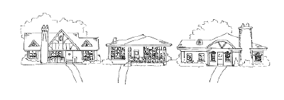
Deed restrictions in Bluebonnet Hills specified that homes must cost at least $3,500 at the time of construction.

NEIGHBORHOOD DESCRIPTION

Prominent architecture in the area includes prairie bungalow and Tudor cottages. The homes are primarily one story, many constructed with brick and stone or frame with siding. The neighborhood has sidewalks. There are some apartments and duplexes and along University Drive and Berry Street and on Bluebonnet Circle there are commercial businesses.

NEIGHBORHOOD ASSOCIATION

The Bluebonnet Hills #1 Neighborhood Association in the Bluebonnet Hills addition covers only the area to the east of University Drive. Activities include a Crime Watch Program and in some blocks a newsletter. One of the main purposes of the association is to beautify Bluebonnet Circle, using only plants and trees popular in the early 30's when most of Bluebonnet Hills was developed.

Bluebonnet Place Neighborhood Association extends west of University Drive and has several activities, including a newsletter.

SCHOOLS

Elementary
Lily B. Clayton, 2000 Park Place, 817-922-6660 (North of Benbrook St., East of University Dr.)
Westcliff, 4300 Clay Ave., 817-922-6850 (South of Benbrook St.)
Tanglewood, 3060 Overton Park W., 817-922-6815 (North of Benbrook, West of University)

Middle
W. P. McLean, 3816 Stadium Dr., 817-922-6830

High School
R. L. Paschal, 3001 Forest Park Blvd., 817-922-6600

OTHER INFORMATION

Nearest Fire Station: 3501 South Hills Ave., 817-871-6800, emergencies: 911
Nearest Medical Facilities: Baylor All Saints Medical Center, 1400 Eighth Ave., 817-927-6102
Nearest Post Office: 2600 Eighth Ave., Berry St. Station, 817-924-0673.
Nearest Grocery Shopping: Berry Street and Westcliff Center
Nearest Mall: Hulen Mall
Nearest Park: Forest Park and Bluebonnet Circle
City Council District Number: 9
School District Number: 5
Voting Precinct Number: 1298


This information was conceived, researched and written by Wini Klein, REALTOR®, for the Greater Fort Worth Association of REALTORS®, with assistance from the City of Fort Worth Planning Department, Historic Preservation Council for Tarrant County, Historic Fort Worth, Inc., Texas Christian University, Junior League, Fort Worth Independent School District, Tarrant County Tax Office, League of Neighborhoods and encouragement from the Fort Worth Chamber of Commerce.

© 1999, 2007, Wini Klein


Berkley Place | Bluebonnet Hills | Colonial/Bellaire | Fairmount | Mistletoe Heights
Overton Park | Park Hill | Ryan Place | South Hills | Stonegate | Candleridge | Wedgewood
Tanglewood | TCU Area | University Place | University West | Westcliff